Review by Dr David Smith
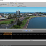
Creating professional quality travel animations and beautiful maps with 3D-rendered tourist features has long been the domain of two software packages from Motion Studios, founded in 1999 in Bremen, Germany. With its origins in the brilliant AMIGA platform Motion Studios gained an impressive reputation in the world of video and animation processing and effects. Travel animations are handled by Vasco Da Gama, mapping by Street Maps.
I have reviewed both packages for more than a decade and have always been impressed by the fact that each new release represents a significant improvement in both the speed and efficiency of the internal workings as well as important improvements in the user interface. Each year the programs become more powerful and easier to use.
The latest versions reviewed here are Vasco Da Gama 16 HD Ultimate and Vasco Street Maps 11 Ultimate Pro. These are the bells and whistles releases which come replete with all of the specialist options such as 3D modelled ships and aircraft all with the correct company liveries and a vast range of vehicles, wild animals and cartoons.
The most significant improvement comes with the switch of both programs to 64-bit architecture. Coupled with the ability to spread the computational load between all available CPU cores, as well as the use of the high-efficiency JPEG XL format for elevation data leads to greatly increased loading and processing speeds. In practise, this means that working with maps feels more lively and fluid, so your creative flow of ideas is not interrupted by lengthy loading delays.
There are so many new features in both programs that you are well advised to head off to the website at https://motionstudios.de to explore all the examples and sample videos available there.
A novel idea – combine both programs
Having worked with these products for years, I would like to make the point that the programs are now so tightly integrated that I foresee a new combined package in which, for example, you would open Vasco Da Gama and have an option of a Street Maps tab on the main program interface. That way you could specify and edit each map as required all within Vasco Da Gama.
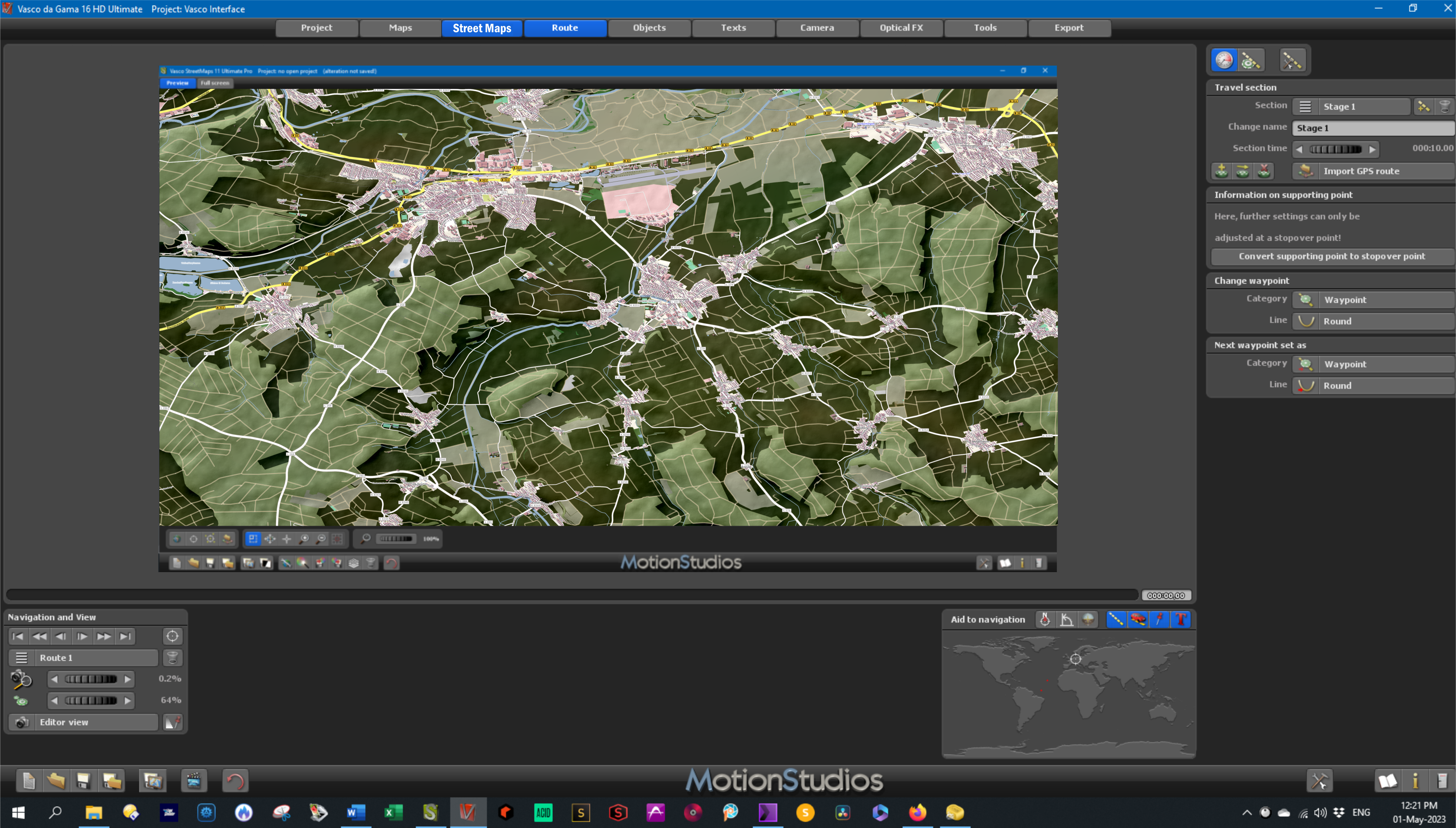
Vasco + Street Maps Combined Interface mockup
Of course it’s very straightforward to work with both programs open now but Motion Studios have always listened to user suggestions which is why the software evolves so rapidly and effectively over time.
I have personal experience of this, having suggested at one time it would be great to be able to switch off federal borders over water. After brief discussion with Ingo Kleefeld at Motion Studios the new option was fully implemented by the time the next release appeared. That was impressive!
Great new features
Vasco Da Gama 16 HD Ultimate
Here is a small selection of some the most powerful new features in Vasco Da Gama 16 HD Ultimate.
GPS database 4.5 million locations to choose from
Fly In and Fly Out Automatically choose from 23 preset Fly in/Fly out animations to add a pro touch to the beginning and end of your video.
SatMapPro 2 This subscription option (free for the first year) provides an ultra-clean satellite view of the earth. All distortions originating from clouds, thermal effects and aircraft contrails have been meticulously removed resulting in an unusually clear and detailed view of the entire planet.
Cloud and wave animations are now more adjustable for wind direction and strength, cloud type and wave reflections.
Dynamic sun angle adjustments allow you to set up the most photogenic arrangement to suit the mood of your video. Having adjusted the sun’s position at key moments in time, all of the other times of day are calculated automatically.
Easy flight mode is now extended to Easy Motorcycle mode which tilts the motorcycle realistically when cornering. This also works for bicycles. I love this mode!
Overall the amount of data included in Vasco Da Gama has been significantly increased in all versions as shown in this table:
| Library with 3D objects | approx. 350 | approx. 350 | over 3.000 |
| Number of GPS database entries of cities, capitals and villages | 365.269 | 4.526.205 | 4.526.205 |
| Degree of detail (map size in pixels) for land mask, night lights, city names and country borders | 65.536 (0.26 GB) |
262.144 (1.81 GB) |
262.144 (1.81 GB) |
| Degree of detail (map size in pixels) for mountain landscape | 65.536 (0.22 GB) |
524.288 (9.75 GB) |
524.288 (9.75 GB) |
A total of 300 GB of map data includes satellite and elevation data and 40 GB of additional vector data.
JPEG XL format for all elevation data for smaller files and higher detail. This new format also supports an alpha channel Extremely large maps of more than 100,000 pixels can now be stored as a single TIFF file.
Change from Overview to Tile map mode and back again at any time in your project. Even huge maps can now be prepared for instant import into Vasco Da Gama.
Multi-GPS selections will automatically generate a map section that includes all of the points. Similarly, this also happens when GPS tracks are imported into Street Maps.
Colour schemes can be selected from a wide variety of loadable colour schemes. You can also modify and scheme to suit your needs and save it for later use. As in Vasco Da Gama, everything is customisable to help you save time in future projects.
Traps for the unwary
Vasco Street Maps is an immensely complex piece of software. There are thousands of options available to tailor your maps to precisely match your needs. Inevitably, with so many variables available, you may sometimes find that seemingly strange things are happening. These issues are not bugs but adjustments you can make to suit your needs. Most are intuitive; some require a quick read of the user manual; others may be solved by posing a question to one of the forums. Here’s one display issue I encountered, and how I solved it.
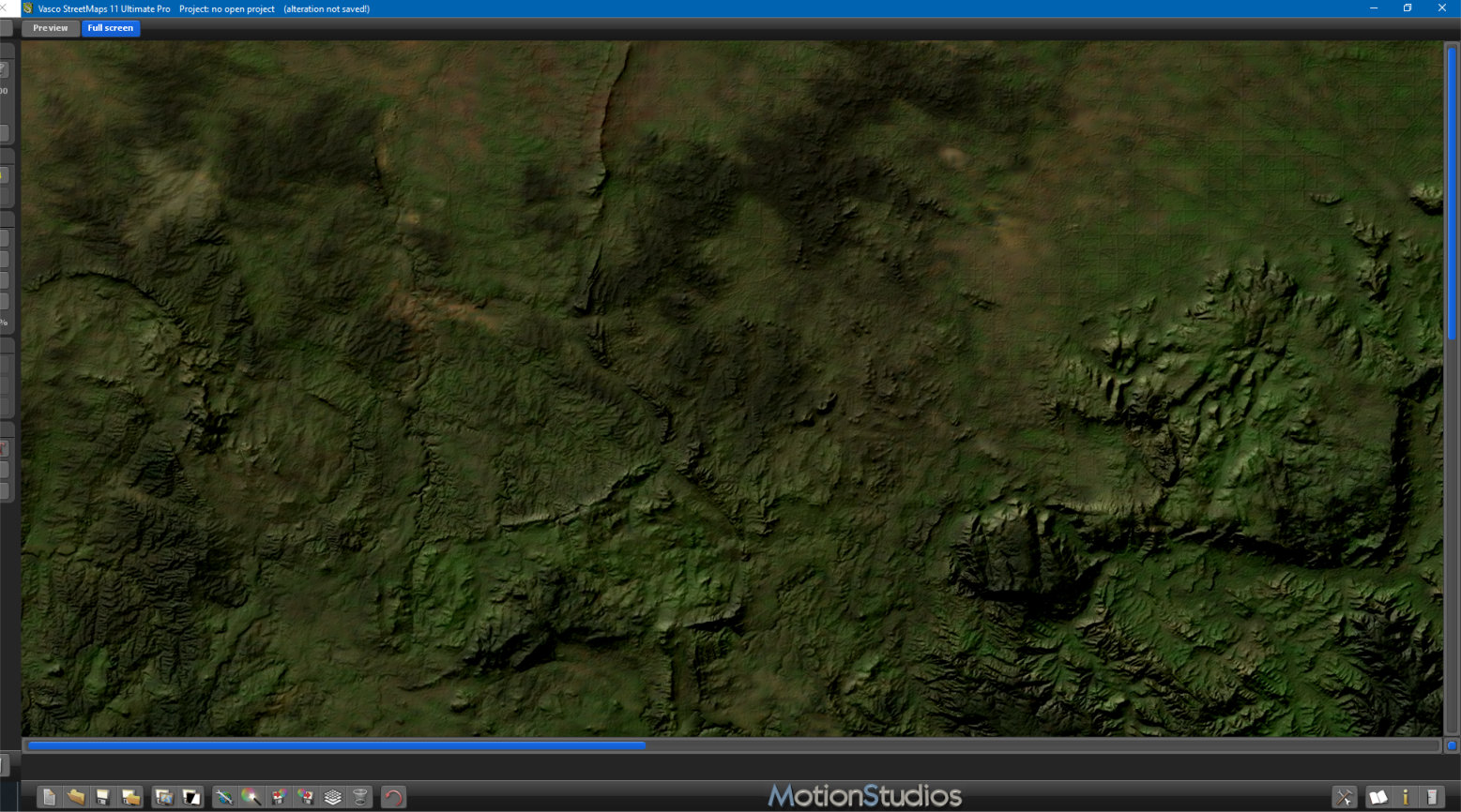
When working with maps to support various videos I noticed what seemed to be artefacts in various parts of the map. I wasn’t at all certain what was causing these areas which were quite clearly delineated and of various plain colours. You can clearly see these regions in various shades of pale green in this screenshot.
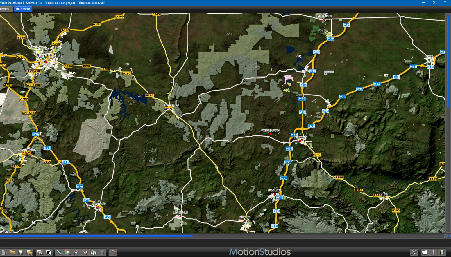
Default map showing pale coloured regions
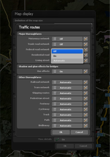
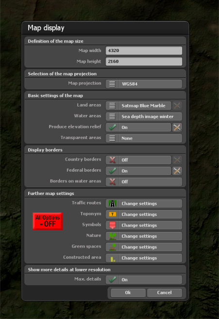
It took me some time to realise that these were regions specifically highlighted according to the preferences selected in the Further Map Settings panel within the Map Display menu.
By default, almost all of these are switched on or set to Automatic.
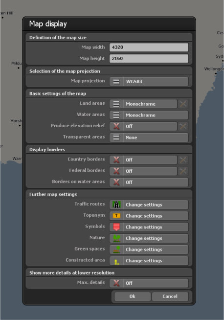
Default Map Display settings
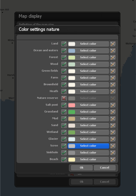
Default settings for ‘Colour settings Nature’. Note almost all checked ON
If you need a map with none of these regions highlighted in this way, you have to go through all the menu items and switch them individually to OFF. This especially applies to the Nature and Green Spaces tabs.
Turning OFF all options manually
Here’s the same map with all of these options turned OFF.
Map with all options OFF
My recommendation to Motion Studios is to add a new button to each tab within the Map Display menu allowing to to click
ALL OPTIONS = ON or
ALL OPTIONS = OFF.
Here’s simple mock-up of how it might look:
Mock-up of menu with new button showing ‘All Options =OFF’. Button will change to green when ‘=ON’
This would allow you start with a clean map and add just those features you’re specifically interested in, without having to manually switch all of the features individually.
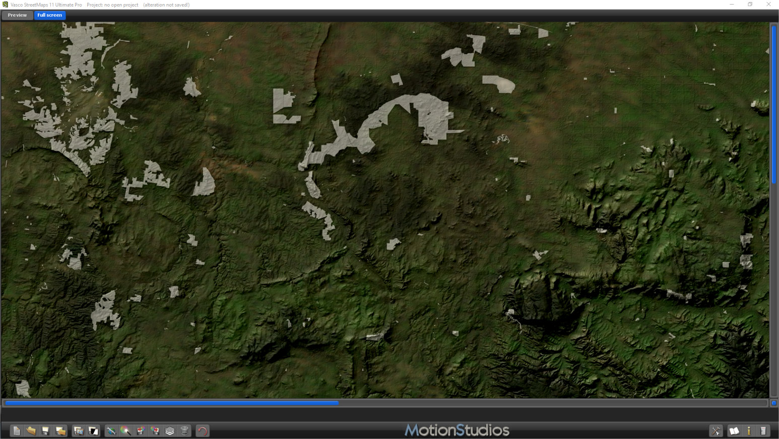
Map with just Nature Reserves highlighted in white
In this image I have selected nothing but Nature Reserves in White. I hope this option will be implemented because I think it could be extremely time saving and handy in many situations.
Conclusion
The move to 64-bit provides a real turbo-charge for the user experience in both Vasco Da Gama and Street Maps. Even with truly massive files, the loading and processing times are remarkably fast. Both programs now feel even more fluid and responsive which makes the creation process a delight.
Numerous tweaks to the user interface and the underlying engine make most operations highly intuitive and, perhaps most of all, the resulting maps and videos are of the highest professional quality. Whether you’re producing a weather map for broadcast TV, a home travelogue, or a feature documentary, these high-end products from Motion Studios will fulfil all of your needs. And apart from that, they’re great fun to use and explore! Highly recommended.
https://motionstudios.de
Vasco Da Gama 16 HD Ultimate €399
Vasco Street Maps 11 Ultimate Pro €299